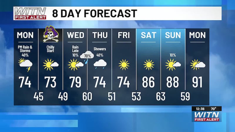
Calmer Tuesday anticipated for all of Eastern NC
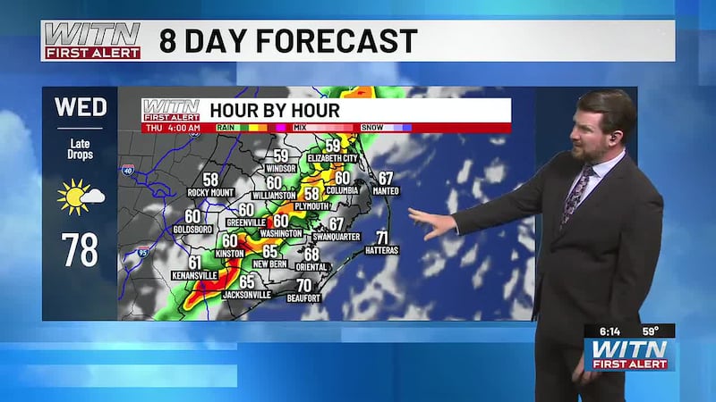
Watching for another round of rain late Wednesday to early Thursday

Cooler high pressure is building into the region, bringing a more comfortable Tuesday with mostly sunny skies. Highs will reach the low 70s inland, while communities closer to the coast stay cooler in the 60s. A few spots along the Outer Banks may hold in the lower to middle 60s for much of the day.
The coast and marine areas will still deal with lingering impacts from gusty northeast winds and elevated seas early today. Small Craft Advisories remain in place for portions of the coastal waters as seas gradually improve through the day.
The next weather maker arrives quickly. Monday’s front will lift back north as a warm front late Tuesday into Wednesday, allowing warmer and more humid air to return. Another cold front then moves across the area Wednesday night into Thursday, bringing the next round of showers and thunderstorms.
At this point, the midweek system has enough wind energy to watch, but the timing may not fully favor a more organized severe weather threat. If the front arrives outside of peak afternoon heating, instability may be more limited. Still, the First Alert Weather Team will monitor trends closely.
Behind the midweek front, high pressure builds back in and shifts offshore. That should lead to a warmer and mainly dry stretch from Friday into the weekend.
Download the WITN First Alert Weather App for free from the Google Play or the App Store.
Copyright 2026 WITN. All rights reserved.