A tropical depression or storm could form this holiday weekend
Rain chances rise late Saturday into Sunday
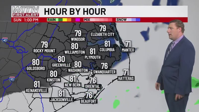
The WITN Weather Team continues to keep an eye on the Southeast coast as we head into the holiday weekend. A tropical depression could form as early as Saturday. The overall chance of development remains at 70% with a 70% chance in the next 48 hours.

Don’t cancel plans today or Saturday, but be prepared for Sunday. Our in-house model is more aggressive with low-pressure development in the Atlantic. It’s possible Tropical Storm Watches could be issued for parts of the East Coast. The current forecast shows increasing rain chances Saturday night into Sunday. Some of the rain could be heavy, and we’ll have to watch for a tornado threat depending on the track. Wind doesn’t seem like a major issue at this time, gusts near 40 mph along the coast can’t be ruled out. Still in the watching phase for now, be ready to make preparations depending on how the forecast progresses. The next name on the list is Chantal.

For more on this system and its impacts on the rip currents, download the WITN Weather App.
Copyright 2025 WITN. All rights reserved.