Russell’s First Alert Forecast: Hit or miss showers and storms Tuesday
Gusty winds, downpours and frequent lightning
The storm threat is not done yet. After a brief lull in activity this evening, our attention turns to another round of storms this morning. A disturbance tracking out of South Carolina could lift towards the area before sunrise. While this potential storm cluster remains uncertain in its exact track, it could bring gusty winds and lightning during the early morning hours.
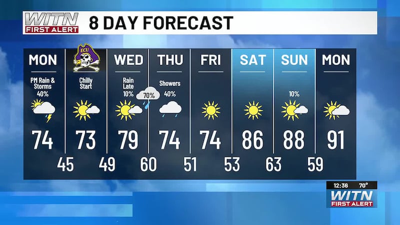
Tuesday won’t offer much of a break. The unsettled pattern continues with warm and humid conditions fueling scattered thunderstorms Tuesday afternoon. Some storms may turn strong with gusty winds and brief downpours.
Wednesday brings more of the same as a slow-moving front drifts into Eastern North Carolina. Strong heating, ample moisture, and moderate instability will once again combine to support scattered storms. Rain chances remain elevated through Friday as the front stalls near our region and sea breeze boundaries spark daily rounds of storms.
By the weekend, storm chances may ramp up again as new upper-level energy returns to the area, finally pushing the front offshore—but not before another unsettled stretch. Daytime highs will stay seasonable in the mid to upper 80s, but feel warmer thanks to high humidity.
For more information, download and check the WITN Weather App for live radar and video updates.
Copyright 2025 WITN. All rights reserved.