Tropical development chance holding at 10%
System could bring some heavy rains regardless of development
As of Tuesday afternoon, the National Hurricane Center continues to maintain a 10% chance of tropical development late this week off the southeastern U.S. coastline.

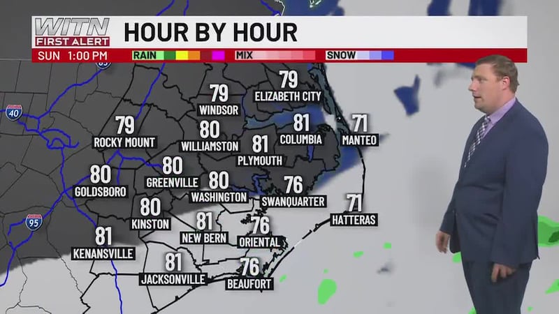
A non-tropical low-pressure system will slowly make its way up the East Coast from Florida to the Carolinas this week. If the system remains offshore, the low could slowly lose its attached warm and cold fronts turning it into a subtropical or tropical system. Chances remain very low Tuesday morning. 10% chance of development over the next 48 hours. 10% chance of development through the next 7 days.

Regardless of development, this system will likely bring rain up the East Coast. ENC’s highest rain chance arrives Thursday into Thursday night. Depending on the strength of the system, breezy conditions could raise the beach erosion and rip current risk, too. At this time, we don’t expect major issues with this system, although pockets of flooding could become a concern given the slow movement of the storm. Stay tuned in case things change.
For more on the tropics, download the WITN First Alert Weather App.
Copyright 2025 WITN. All rights reserved.