Warm Mother’s Day ahead!
Watching for rain & storms on Monday
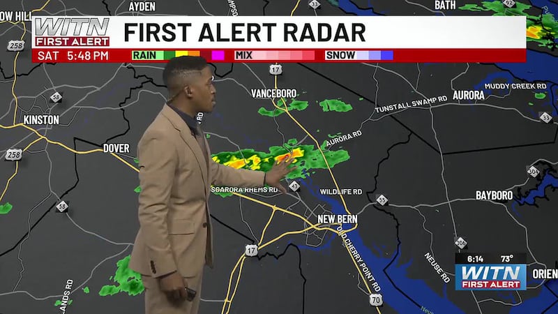
A few isolated showers and thunderstorms will remain possible across Eastern NC through this evening, especially across inland communities and areas closer to Highway 70. Rain chances will gradually end tonight as today’s disturbance moves offshore.
The overnight forecast will depend on cloud cover. If clouds clear faster than expected, patchy fog could develop late tonight into early Sunday morning due to light winds and a moist boundary layer. If clouds linger, fog development should be more limited.
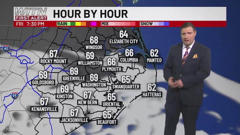
Sunday looks mostly dry and warmer. Highs will climb into the upper 70s and mid 80s under a broad southerly flow. A stray afternoon shower or storm may develop along the sea breeze, but most of the area should stay dry.
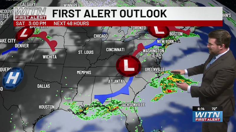
Attention then turns to Monday as a stronger cold front moves through Eastern NC. Widespread rain is expected, with rain chances around 70% to 90%. A few thunderstorms could become strong to severe, especially near and south of Highway 70 where instability may be higher during the afternoon. The main concerns are gusty winds, hail, and heavy downpours. Many areas could pick up a quick half inch to one inch of rain, with locally higher totals possible along the southern coast.
Behind the front, cooler and drier air moves in Tuesday. Morning lows may fall into the upper 40s, with highs only reaching the upper 60s. The weather turns quieter for midweek before another front brings the next chance for showers and storms around Thursday.
Download the WITN First Alert Weather App for free from the Google Play or the App Store.
Copyright 2026 WITN. All rights reserved.